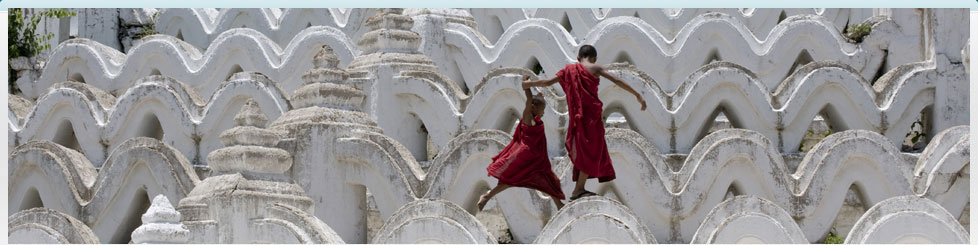
Other Interesting Places
Kyaik Hti Yo (The Miracle of Golden
Rock)
- Originally it was called Kyaik-I-Thi-Yo in Mon language.
- It means the pagoda carried by a hermit's head.
- Located on the edge of the Paunglaung mountain range in
Mon state.
- 3600ft (1090m) above the sea level.
- It takes one hour to the upper staging point by the open
truck which is uncomfortable.
- It takes one hour walk up a steep path which ascends to
the Golden Rock.
- If you don't want to climb, you can sit back and be
carried in sedan chairs by four porters.
 This
pagoda is located in Mon state and famous for the balancing of
the stone. Originally it was called Kyaik-I-thi-Yo in Mon
language. It means the pagoda carried by a hermit's head. With
the passage of time, it came to be known as Kyaik Hti Yo. This
Pagoda is located on the edge of the Paunglaung mountain range,
part of the eastern Yoma in Kyaikhto township in Mon State,
3600ft (1090m) above the sea level. This
pagoda is located in Mon state and famous for the balancing of
the stone. Originally it was called Kyaik-I-thi-Yo in Mon
language. It means the pagoda carried by a hermit's head. With
the passage of time, it came to be known as Kyaik Hti Yo. This
Pagoda is located on the edge of the Paunglaung mountain range,
part of the eastern Yoma in Kyaikhto township in Mon State,
3600ft (1090m) above the sea level.
It is said to be enshrined with the Buddha's hair relic and
resting on top of a huge boulder that balances on the edge of a
cliff.
The gold -covered rock is roughly in the shape of a man's
head, and it is believed to represent the head of a hermit who
had carried the Buddha's hair wrapped in his own topknot before
he died. He had left instructions that such a boulder was to be
found and the precious hair enshrined in a pagoda on its crest
after his death.
 According
to the legend, there were six hermits living on six separate
hills. One day, during the visit of the Buddha to Thahtom, Mon
state, each hermit received Hair relic of the Buddha and instead
of enshrining the sacred Hair they kept themselves. One of the
hermits called Tissa became worried about the sacred Hair when
he grow old and he thought of keeping the sacred Hair in safety.
With the help of Sakka, king of the celestial beings, he found a
boulder in the shape of his head and then a hole was made to
enshrine the sacred Hair in it. According
to the legend, there were six hermits living on six separate
hills. One day, during the visit of the Buddha to Thahtom, Mon
state, each hermit received Hair relic of the Buddha and instead
of enshrining the sacred Hair they kept themselves. One of the
hermits called Tissa became worried about the sacred Hair when
he grow old and he thought of keeping the sacred Hair in safety.
With the help of Sakka, king of the celestial beings, he found a
boulder in the shape of his head and then a hole was made to
enshrine the sacred Hair in it.
The girth of the boulder is 50ft (15m) and the pagoda on top
of the boulder is 15ft (4.5m). A test can be made by passing a
thread from one side to the other side of the boulder that the
boulder doesn't touch the rock below it. Its seems the boulder
will fall at a slight push, but it has been like this since over
two thousands years ago.
Mawlamyine
 Mawlamyine
is the fourth largest city in Myanmar. It is situated 187 miles
away from Yangon. It lies across the Gulf of Mottama at the
mouth of the Thanlwin river. It is the capital of Mon state with
a population of almost 300000 people. It was formerly known as
Moulmein which is the administrative capital of British of lower
Myanmar. The town has a charm of its own with its rich history,
buildings and colonial style architecture. Siam-Burma "death
railway" which is 1 ½ hour drive from Mawlamyaing, make it a
fascinating place to visit. Mawlamyine
is the fourth largest city in Myanmar. It is situated 187 miles
away from Yangon. It lies across the Gulf of Mottama at the
mouth of the Thanlwin river. It is the capital of Mon state with
a population of almost 300000 people. It was formerly known as
Moulmein which is the administrative capital of British of lower
Myanmar. The town has a charm of its own with its rich history,
buildings and colonial style architecture. Siam-Burma "death
railway" which is 1 ½ hour drive from Mawlamyaing, make it a
fascinating place to visit.
Hpa An
 Hpa
An is the capital of Kayin state. It is located ... km away from
Yangon and just one hour drive from Mawlamyine. It is a quite
charming city with many natural lime-stone caves, pagodas and
temple. We can get there by car from Yangon or Mawlamyine. One
can enjoy the sunset on the country-side and can visit Buddhist
caves. Hpa
An is the capital of Kayin state. It is located ... km away from
Yangon and just one hour drive from Mawlamyine. It is a quite
charming city with many natural lime-stone caves, pagodas and
temple. We can get there by car from Yangon or Mawlamyine. One
can enjoy the sunset on the country-side and can visit Buddhist
caves.
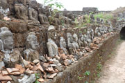
Mrauk U (Ancient City of Rakhine)
- Mrauk U was founded in 1433 A.D by King Min Saw Mun.
- It lies on the rocky plain between the lemyo and Kaladon
rivers.
- The hills around the town stood as the natural defence
line.
- In some places, there are the remains of the fort, built
of hewn-stone and motor.
- There were many temples and solid stupas, built mostly
of stones.
- Inscriptions, coins and stone sculptures have been
unearthed from the various sites.
 Visitors
must come through Sittwe, a bust seaport that has traditional
houses along the waterfront. There are monasteries with a mix of
European and traditional architecture, and the fish market is a
lively place full of men hauling nets and women selling the
catch of the day and fresh vegetables. Visitors
must come through Sittwe, a bust seaport that has traditional
houses along the waterfront. There are monasteries with a mix of
European and traditional architecture, and the fish market is a
lively place full of men hauling nets and women selling the
catch of the day and fresh vegetables.
The ruined city of Mrauk Oo, dating back to the 15th century,
is reached by a five hour boat ride from Sittwe along the
Kakadan River.
The river meanders through farmland, passing fishing villages
and sailing junks, and sometimes through flocks of migratory
wild birds.
 Myanmar's
second most famous archaeological site, Mrauk U, is a
centuries-old city of hundreds of temple around which villages
life thrives. The Kings of Rakhine set up different cities
around the lower reaches of the lemyo and the Kaladan Rivers.
Mrauk U was founded in 1433 A.D by King Min Saw Mun. It was
later known as Mrohaung, meaning the "Old Capital". It lies on
the rocky plain between the lemyo and Kaladon rivers. The hills
around the town stood as the natural defence line. In some
places, there are the remains of the fort, built of hewn-stone
and motor. There were many temples and solid stupas, built
mostly of stones. Inscriptions, coins and stone sculptures have
been unearthed from the various sites. Myanmar's
second most famous archaeological site, Mrauk U, is a
centuries-old city of hundreds of temple around which villages
life thrives. The Kings of Rakhine set up different cities
around the lower reaches of the lemyo and the Kaladan Rivers.
Mrauk U was founded in 1433 A.D by King Min Saw Mun. It was
later known as Mrohaung, meaning the "Old Capital". It lies on
the rocky plain between the lemyo and Kaladon rivers. The hills
around the town stood as the natural defence line. In some
places, there are the remains of the fort, built of hewn-stone
and motor. There were many temples and solid stupas, built
mostly of stones. Inscriptions, coins and stone sculptures have
been unearthed from the various sites.
Kyaing Tong
  Kyaing
Tong, a capital city in the Eastern Shan State, is known for its
scenic beauty and colourful hill tribes. The road from Tachileik
to Kyaing Tong wind 160km over the mountains, forests, streams
and tribal villages. Palaces of interest in Kyaing Tong include
Maha-Myat-Muni Pagoda, Naung-Tong Lake, Sunn-Taung Monastery,
Hot spring and One Tree Pagoda, Loi-mwe, meaning misty mountain
over 1600 meters above the sea level is located 33km away from
Kyaing Tong. It commands a magnificent view of the surrounding
place and it enjoys a temperate climate. Once an outpost of the
British, there remains many colonial style buildings and an old
catholic church. Kyaing
Tong, a capital city in the Eastern Shan State, is known for its
scenic beauty and colourful hill tribes. The road from Tachileik
to Kyaing Tong wind 160km over the mountains, forests, streams
and tribal villages. Palaces of interest in Kyaing Tong include
Maha-Myat-Muni Pagoda, Naung-Tong Lake, Sunn-Taung Monastery,
Hot spring and One Tree Pagoda, Loi-mwe, meaning misty mountain
over 1600 meters above the sea level is located 33km away from
Kyaing Tong. It commands a magnificent view of the surrounding
place and it enjoys a temperate climate. Once an outpost of the
British, there remains many colonial style buildings and an old
catholic church.
Hsipaw
 Hsipaw
is a quite charming town which is situated on the bank of
Dotthawaddy River. It is about 1500ft above the sea level in the
Northern Shan State. In the olden day, it was ruled by Shan
Saobwa (sky-lord). The rain trees provide a shade along the
street framed by family owned shops, markets and restaurant. The
population is about 30,000 with the remaining minorities in
Myanmar such as Palaung, Lisu, Kachin, Kayin, Hindu and Chinese.
The surrounding countryside grows seasonal crops such as
oranges, peaches, pineapple and watermelon, cauliflower,
mustard, broad beans, carrots, etc. One can explore to the
Jungle and enjoy the authentic nature with giant trees, bamboo
forest, mountain range, splendid lake. Hsipaw
is a quite charming town which is situated on the bank of
Dotthawaddy River. It is about 1500ft above the sea level in the
Northern Shan State. In the olden day, it was ruled by Shan
Saobwa (sky-lord). The rain trees provide a shade along the
street framed by family owned shops, markets and restaurant. The
population is about 30,000 with the remaining minorities in
Myanmar such as Palaung, Lisu, Kachin, Kayin, Hindu and Chinese.
The surrounding countryside grows seasonal crops such as
oranges, peaches, pineapple and watermelon, cauliflower,
mustard, broad beans, carrots, etc. One can explore to the
Jungle and enjoy the authentic nature with giant trees, bamboo
forest, mountain range, splendid lake.
Kayah
 Kayah
state is another one of those uniquely Myanmar destinations
that's open to foreign tourists. It is situated between Shan
State to the north and Kayin State to the west and south and
Thailand to the east, Kayah State is home to a disproportionate
number of tribal group, including the Padaung, Yinbaw, Bre,
Kayin and Karenni. Kayah
state is another one of those uniquely Myanmar destinations
that's open to foreign tourists. It is situated between Shan
State to the north and Kayin State to the west and south and
Thailand to the east, Kayah State is home to a disproportionate
number of tribal group, including the Padaung, Yinbaw, Bre,
Kayin and Karenni.
|
|
|